Banbury to Oxford
Route by James Davies
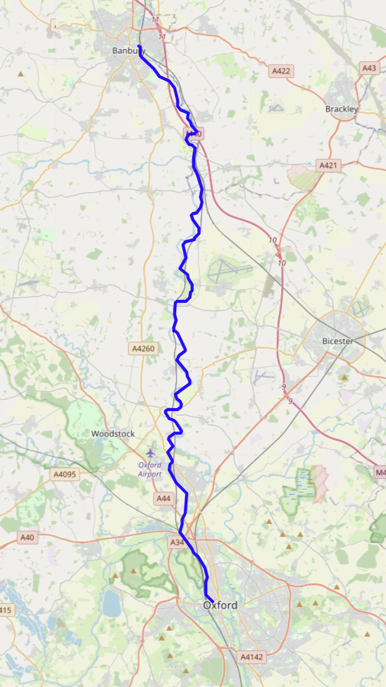
The route takes you along the path of the Oxford Canal from the centre of Banbury to the Centre of Oxford. Route finding is easy - just keep to the towpath. Access the start of the route in Banbury town centre, a short ride from the railway station. The canal leaves the urban environment and heads into the Cherwell Valley. The railway line is a constant companion - you should make a diversion and visit the Souldern viaduct.
The tow-path is mostly single-track, non-technical, a hybrid or gravel bike will be fine. Some parts of the tow-path that are narrow, eroded, or overgrown. If you aren't completely confident in your balance there will be some hike-a-bike. Avoid the route after heavy rain - if the river Cherwell is in flood everything will be very wet. The railway, canal, and river mean that there are a few stretches with no easy options for getting back to a road.
There are no shops without leaving the route, but there are water and facilities at many of the moorings (Aynho, Lower Heyford, Kings Ground, Thrupp) but they may be locked (get a key from the Canal and River trust) or in use. The only cafe directly on the route is Annies at Thrupp which is definitely worth the stop.
As you get closer to Oxford the towpath becomes paved and populated. If it's too crowded to cycle, cross on one of the bridges and cycle through the city Centre. The route ends a short distance from Oxford railway station.